

UNIFY.C2 Demonstrates Rapid Multi-Modal Integration at CENTCOM's EXTiC 26-2 Technology Experimentation Event
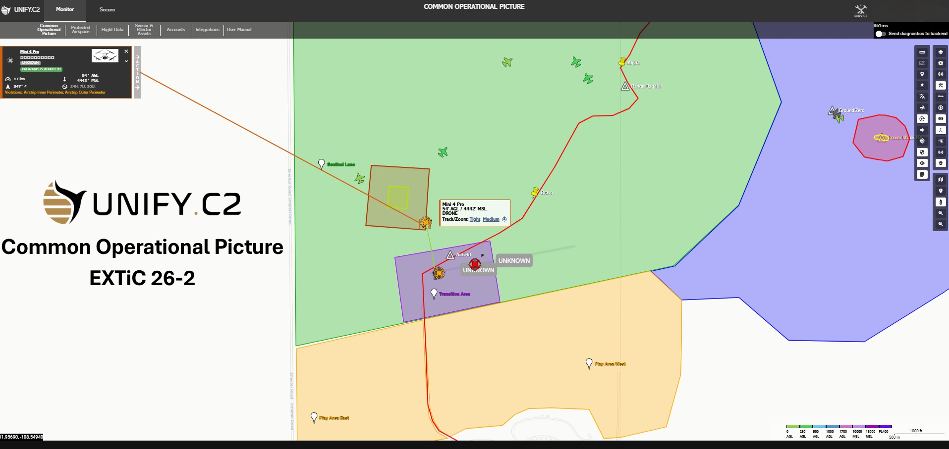
UNIFY.C2's Common Operational Picture (COP) was demonstrated at CENTCOM's EXTiC 26-2 Technology Experimentation Event, providing operators with a unified view of airspace activity with real time sensor fusion, track correlation, & mission management
Selected as one of 21 companies from 149 industry submissions, UNIFY.C2 integrated six sensor modalities from multiple vendors operationally relevant conditions
DALLAS, TX, UNITED STATES, August 5, 2026 /EINPresswire.com/ -- UNIFY.C2, developed by Spatial Persistent Software (SPS), today announced its participation in Experimentation: Transforming in Contact (EXTiC) 26-2, a U.S. Central Command technology experimentation event conducted in July at the Playas Training and Research Center in New Mexico.
Conducted in collaboration with the Defense Innovation Unit, the event brought together emerging technologies for evaluation in operationally relevant scenarios intended to accelerate the transition of new capabilities to the Joint Force.
UNIFY.C2 was one of 21 companies selected to participate following a competitive review of 149 industry submissions. The event evaluated technologies across mission scenarios involving electronic warfare, GPS-denied operations, autonomous systems, and coordinated drone swarms. The objective was to assess how individual technologies could be integrated into end-to-end military operations and perform under contested conditions.
During the event, UNIFY.C2 integrated six sensor modalities from multiple vendors that had not previously been connected to the platform. The integrations were completed rapidly in an operational environment.
UNIFY.C2 combined the resulting detections and tracks into a unified common operating picture, providing operators with real-time sensor fusion and the information needed to identify, assess, and respond to evolving airspace activity.
“EXTiC 26-2 demonstrated that interoperability cannot remain theoretical,” said Jerry McGee, CEO of UNIFY.C2. “In contested environments, operators need diverse sensors and systems brought together quickly into one operational picture. Integrating six different modalities from multiple vendors, never integrated before, demonstrated the platform’s ability to adapt and perform under real-world operational constraints.”
UNIFY.C2 is a vendor-neutral Counter-UAS Mission Command Platform designed to coordinate detection, assessment, decision-making, and response across sensors, agencies, and effectors. The platform supports defense, public safety, law enforcement, and critical infrastructure missions by bringing diverse technologies into a single interoperable command environment without increasing complexity for the operator.
EXTiC supports the Department of Defense’s broader Transforming in Contact initiative, which emphasizes evaluating emerging technologies alongside operational forces in representative environments. Through realistic mission scenarios, CENTCOM and DIU seek to accelerate the transition of promising capabilities from experimentation to operational use while developing repeatable and cost-effective methods for evaluating future technologies.
“The objective is not to give operators another standalone screen,” McGee said. “It is to reduce complexity by bringing detections, tracks, and decision-relevant information into a single command environment at mission speed. We appreciate the opportunity to work alongside government and industry partners focused on improving interoperability and operational readiness.”
About UNIFY.C2
UNIFY.C2, developed by Spatial Persistent Software, is a vendor-neutral Counter-UAS Mission Command Platform that coordinates detection, assessment, decision-making, and response across sensors, agencies, and effectors. The platform provides real-time sensor and data fusion, multivendor integration, and a unified common operating picture for defense, public safety, law enforcement, and critical infrastructure missions.
Molly Risak, Director of Marketing
SPS Aerial Remote Sensing
+1 949-636-4756
mrisak@spsars.com
Visit us on social media:
LinkedIn
Legal Disclaimer:
EIN Presswire provides this news content "as is" without warranty of any kind. We do not accept any responsibility or liability for the accuracy, content, images, videos, licenses, completeness, legality, or reliability of the information contained in this article. If you have any complaints or copyright issues related to this article, kindly contact the author above.
